
UPDATE: PLEASE GO TO WWW.EIREMARKINGS.ORG FOR MORE INDEPTH INFORMATION ON THIS SUBJECT. 26 SITES STILL REMAIN.
In 1986, I went to Donegal on a family holiday and before we were finally washed all the way down to Hurricane Charlie and Bantry Bay, we visited Malin Head on a cloudy, cool enough day. I don’t remember very much about it, but I remember seeing markings on the headline pointing out that this was Eire. We’d never seen them before, and somewhat surprisingly, my mother didn’t know anything about them. After some careful consideration, I assumed it went back to the early years of the state, and possibly linked to the fact that Malin was the pointiest bit north of the country. Logically I wouldn’t have been surprised to know they existed on Slyne Head (west). Mizen (south) and Wicklow Head (east).
In fact, they probably did, but it had little to do with the earliest years of the state. The subject of those markings came up during the week and somewhere along the line, between 1986, and 2012, I did learn that they had something to do with the Emergency. Following the discussion I had with a colleague during the week, I started looking in to them again. The best known appears to be the one on Malin, but it is far from being the only one. I tracked down the one on Malin on google maps and, having done a little research around them, I realised there really is no clear piece of information about them on the web.
I’m not a historian but in the way that various things catch my attention, I’m interested enough in these because they are a snapshot of time, and mostly, we tend to march over those snapshots.
During the war years, a number of coastal look out points were built around Ireland to monitor shipping and air traffic. Ireland had declared itself neutral. In total, 84 of these lookout points were constructed. They consisted of what can best be described as a little concrete bunker. About 50 of those structures have left footprints or are still standing. They look cheap, they are built of concrete, and most of them are in a state of disrepair. The only one I can recall ever being in is the one on Brandon Point in Kerry. I took some photographs from it.
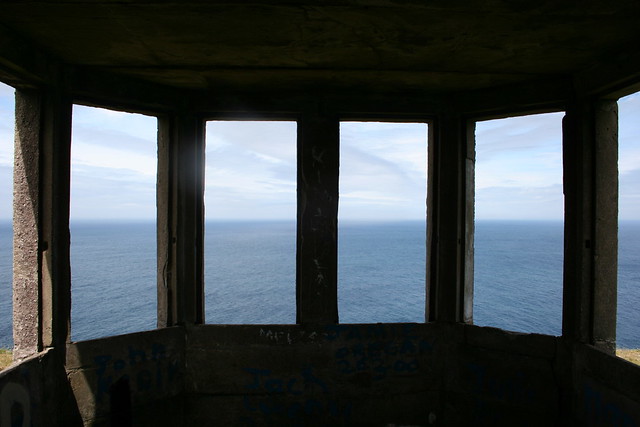
You really have no idea just how small this thing is. There was a tiny fire place in it, and otherwise it was pretty much open to the elements. I don’t know if they had glass in them. Having seen photographs of a lot of them lately, I doubt it. It cannot have been pleasant on a winter’s night in them.
Volunteers were assigned to each of the look out posts on eighthour shifts, one to watch, and take phone calls – these things were on the phone network – to keep abreast of any news from the other posts – one to patrol. Part of this was linked to the risk of an invasion of Ireland, a neutral country. Wikipedia has an interesting entry on Plan W. I really wouldn’t mind looking into that a bit more closely in the future but it’s a good starting point for the purposes of this piece.
The Clare Champion has a piece about the lookout post in Loop Head which is well worth a read.
Each of the lookout posts were numbered, 1 to 84, starting in the north east and finishing in the far north of the country. You can find an overview of the lookout posts here, along with photographs of the sites of all of them. I really appreciate this site because it speeded up some of what I wanted to do during the week quite a lot. Tim Schmelzer deserves an awful lot of kudos for that project but he concentrated mainly on the buildings and for myself, what interested me most was the markings.
According to one comment I have seen, the markings were put in place at the request of the American Air Force. I suspect that not only were they lined up to inform overflying pilots that they were over neutral territory (and shouldn’t be flying over) but as most of them were numbered and seem to face in specific directions, they may have also functioned as navigational aids. You can see this in a number of them. There are existing pictures of the marking in Inishowen, for example, and also of the one on Erris Head in Mayo. Interestingly, the numbers do not appear to have survived in all cases although the EIRE letters themselves have.
What I wanted to do was try and locate them on web available satellite imagery. There is very, very little information about the markings on the web so even now I am not sure how many of them still exist to be seen. If there is more than a dozen, I will be surprised. Most of the information I could glean about them have come from threads on Boards.ie and IrishMilitaryonline.com. From boards.ie I have learned that at least one other person has had a go at mapping them but I haven’t seen any evidence of the map. I initially looked at plotting them on Google but have found that the resolution on Bing’s service is slightly better for key parts of the west of Ireland
Until very recently, the EIRE sign linked to Loop Head was buried. In fact, it was uncovered so recently that you cannot see it on the Google map of Loop Head. Again, according to the Clare Champion it was unearthed and restored this year. The Bing map for West Clare has no resolution for that area.
As things stand, I can locate about ten of the signs on Bing Maps. I’m aware of an additional 1 which is in an area with inadequate resolution. In addition, I believe there are four more between Slieve League and Achill Island which are still visible but I have not yet been able to locate them. The two at Slieve League in particular have been noted as being in a state of disrepair.
Located on Bing Maps.
- Malin Head, County Donegal
- Saint John’s Head, County Donegal,
- Dursey Island, County Cork
- Black Head, County Clare
- Erris Head, County Mayo
- Horn Head, County Donegal
- Melmore Head, County Donegal
- Inishowen Head, County Donegal
- Toe Head, County Cork
- Arranmore Point, County Donegal
- Loop Head County Clare
- Achill Island, County Mayo ( 59 – Given as Moyteogue head on Tim’s site above) (x 2)
- Slieve League, County Donegal (x 2) <<<one of these located, other is now gone
- Baltimore 29 has been renovated. There are photographs of it but I can’t find it on a map (ETA)
My hope was to locate a dozen of them. I’ve a feeling I’ve actually seen the Black Head one driving past and just forgot. I don’t know why. I didn’t expect to find it too easily because I expected it to fade into the background of the Burren stone landscape.
I have seen a picture of one above which I haven’t identified (see here) so I’d obviously like to track that one down as well. The image is very clearly from google, but it doesn’t match any of the ones I have.
When I’ve done all this, I’ll write a proper summary of what I know about these markings and post it to a page either here or on my primary website. The map is very much under construction so I’ll post it here later.
The current map of those I have located is here:
It transpires that to get the pushpins, you need to view the larger map. You’ll also need to choose AERIAL view to get the images. This is not ideal for me – I’d prefer Google but seriously, the resolution is nowhere near adequate in a lot of key places.
There’s a bit of research going into this, so any help would be appreciated. In addition to the map plots on Bing and Google, I will look at seeing if an OSI map can be put together. I’m also interested in collecting photographs of the sites taken from the air, if possible, with a view to tracking changes in their condition. Any help would be appreciated.
Thanks.
Right, first off, be very wary of what is in Wikipedia. I read most of the Irish “Emergency” related articles a few years ago and I can tell you that the ones about the German invasion plans were dreadful. They have have changed, for the better but still…
Instead I’d recommend getting a copy of Robert Fisk’s “In Time of War” from your local library. Its an excellent account of Ireland during WWII and I think I remember it mentioning the markers. http://www.amazon.co.uk/Time-War-Ireland-Neutrality-1939-45/dp/0717124118/ref=sr_1_5?s=books&ie=UTF8&qid=1355088038&sr=1-5
In terms of imagery, have you tried the OSI’s site? They have a public viewer: http://www.amazon.co.uk/Time-War-Ireland-Neutrality-1939-45/dp/0717124118/ref=sr_1_5?s=books&ie=UTF8&qid=1355088038&sr=1-5
As well as the maps down the right side you can select “ortho” 2005, 2000 and 1995 (in B&W). These are the OSI’s own aerial surveys of the country. And they cover the entire country! You should find a lot of what you are looking for there.
Finally, I can add one to your list. On Achill Island, just south of Keem above the cliffs there is a look out there. I have sheltered in it from rain when walking out to the head myself. To find it on the OSI map, go to Ortho 2000 (best contrast for this area) and follow the path south from the beach. It actually runs up a hill and there is one kink SSW. Where it ends at the cliffs is where the hut/shelter is. Google Maps has a picture: https://maps.google.com/maps?q=achill&hl=en&ll=53.964822,-10.195913&spn=0.018657,0.040641&sll=53.32432,-6.251695&sspn=0.301439,0.650253&t=m&hnear=Achill&z=15&layer=c&cbll=53.964822,-10.195913&cbp=12,0,,0,0&photoid=po-20288150
Hope this helps!
Woops double pasted the Amazon link instead of giving you the OSI one: http://maps.osi.ie/publicviewer/#V1,455648,803753,6,4
Hi Seamus.
Michael Kennedy of the Royal Irish Academy wrote a book about five years ago called Guarding Neutral Ireland which is the definitive guide to the coast watch service during the war. You can get it in Books Upstairs for around 9 euro at the moment and it is proving to be quite informative (normal list price: quite a bit more) in many respects. Based on some comments within it, it is entirely possible that documentation relating to the signs themselves is thin on the ground which is a pity because one of the things which is intriguing me is the direction in which the signs have been painted. I can see some rationale behind the painting of multiple signs but will probably have to go through the 1942/43 log books for each of the LOPs (if they are available) to see if there is any other useful information. In some cases,. duplicate signs were erected because the first one was too small. The numbers were added after the signs were put in place – they do not appear to have been part of the initial decision of implementing the signs.
I’m aware of the look out on Achill over Keem – have never been up there myself but can see it from the beach. I have seen some comments to suggest two signs were put up on Achill for that particular LOP, one eight kilometres from the LOP which means I will need to scan most of the island I think although instinctively I suspect this is on the northern coast of the island rather than the southern.
I’m having mixed success with the OSI coverage to be honest. There are some contrast issues which mean that even signs which I know exactly where they are are not coming up for me (a key example is Black Head in Clare which is perfectly clear on both Google and Bing but not on the OSI service). I have been advised to go and talk to their aerial photography people anyway as that might bring me more so I will do that also.
Apparently there are two on Malin Head. This is interesting because I’ve actually only found one so far.
Hi Treasa, re, the other Achill one. It’s in Currane which is not on the Island but on the Currane Peninsula just on the shores of Clew Bay. It’s part of the Achill Parish and the postal address is Achill. I’ve tweeted you the location. I live just near it. It’s no. 58.
🙂 Jane
Hi Jane,
I just picked up the tweet and yes, it’s No 58 – linked to the look out post in Corraun. This brings to 20 the number still in existence and 19 the number identified on a map. The missing one is Loop Head which was renovated last year and could not be seen on sat imagery prior to that.
Hi Seamus, interesting to read about those Eire signs. Mick’s mother used to say there was one at Brandon Point to inform German planes that they were flying over Ireland. I was under the impression that it was the locals who put it there. But with time unless they are kept clear, grass and weeds grow over them! Noreen
Hi Noreen,
The look out hut for Brandon Point is still there but I don’t know where the sign was/is relative to it so I haven’t found it. I’m guessing it was further up the coast from the hut (it’s the one in the picture above by the way) or, as has happened elsewhere, the carpark might be plonked on top of it.
The signs were built by the locals as it happens; they were generally built by the men attached to the look out post – building the signs was part of their duty in 1942/1943. All the signs were subject to an aerial inspection when they were complete. But the driving force for building them came from the American ambassador in Dublin at the time who wanted to minimise the likelihood of American airplanes on operational duty crashing in Ireland and reduce the risk of internment.
Initially they consisted solely of the EIRE marking. The numbers were added shortly afterwards and the numbers tend to be thinner in a lot of cases than the letters in the EIRE marking.
The number of sites identified with markings or remnants of markings now stands at 15 by the way.
LOP Here in distance.
http://goo.gl/maps/bnLGj
No Eire sign around there.
Hi Treasa,
I have another very clear EIRE sign for you… on Inismore Aran Islands http://www.panoramio.com/photo/5540746?source=wapi&referrer=kh.google.com
There is also a 53 number visible above a very indistinct ‘RE’ in Connemara, beside the WW2 lookout post on top of Doon Hill, Bunowen, Ballyconneely, Clifden.
Thank you for getting info on all the satelite EIREs in one place. I have found a few more that are not on your map…
Sheeps Head, Co Cork has an EIRE sign about 300 meters from the end of the penninsula, about half way up the southern slope directly below a circular structure on top of the headland, on Bing maps.
Glengad Head on Inishowen has an EIRE sign at the edge of the cliff, directly north of a cluster of 3 houses in Glentoskert. not visible on Google but clear on Bing Maps.
Renvyle Head Co, Galway has a very indistinct green RE visible in a field by the shore, about 200 meters WSW of the only place where the road reaches the west facing beach, again on Bing maps.
BTW the Eire sign on Loop Head is now visible on Bing Maps.
Hello again, 🙂
This video from the BBC Coast series identifies a second EIRE sign at LOP 71, Carrigan Head. Part of the RE is just about visible on Bing maps just below the Z shaped road in the way to the Slieve league carpark. A sheep appears to be standing on the number 7 above the sign and another one on the 1 !! 😉
http://www.youtube.com/watch?v=phv3HoxH1qs&feature=player_embedded
Also LOP 53 known as Slyne Head actually is on top of Doon Hill, Ballyconneely. Perhaps there is a second EIRE sign closer to Slyne Head but there is a lot of blowing sand in that area, so I imagine it has been long lost under the sod.
Hello, this is a fascinating website and i’m very interested in gaining knowledge about these LOP’s and the EIRE markers, here’s a link a post I made to the Pillbox Study Group forum with pictures of the LOP at Clogherhead in County Louth, http://pillboxstudygroup.freeforums.org/clogherhead-lookout-posts-rep-of-ire-t732.html
Here is a link to a page on the history of Clogherhead and it mentions the existance of an EIRE marker near the lookout post, I have searched for this and I am yet to find it.
http://www.clogherhead.com/index.php?option=com_content&view=article&id=73&Itemid=80
I look forward to hearing from you
Hi again Teresa,
I sent this mail to you some time ago on your ‘GPS of the past’ site but you may not have received it… so I send it again on this site.
I believe I have spotted 4 more EIRE signs for you, one good one and three fragments, where a bit of imagination and eye squinting is required. ;-))
LOP 67 Aughris Head, Co. Sligo has ditches from an ancient promontory fort easily visible at the tip of the peninsula. There is a green EIRE sign, with an indistinct green number 67 above it, in the center of the 4th field to the west of the promontory fort field. Best viewed on Bing maps, Birds eye view, rotated so you are looking from the north. Also visible on OSI 1995 map here http://maps.osi.ie/publicviewer/#V1,550166,836745,7,5
LOP 44, Kilcredaun Point, Co Clare. There is a crossroads 1.4 km north-west of the Napoleonic gun battery fort at the tip of the peninsula beside a large brown field with an irregular lake in it. All four roads of the crossroads are called ‘Rahona East’ on Bing maps Aerial view. 30 meters south of the crossroads some of the frame and an indistinct letter ‘E’ can be seen just to the west of the road.
LOP 9 Wicklow Head, Co Wicklow. There is an old tower 300 meters due west of the modern Wicklow Head lighthouse, with a road skirting close to it. A green tufted grass ‘E’ can just about be seen on Bing maps, Aerial view, 15 meters to the north-east of the tower. I was unsure about this one, but enlargment of the first of your Historic Aerial Photographs confirms that this is exactly where the last ‘E’ of the EIRE sign was situated.
LOP 71 Carrigan Head Co. Donegal. I note you have not included the second EIRE sign there, the one which featured in the BBC Coast series http://youtu.be/phv3HoxH1qs . It is visible on the 2005 OSI map http://maps.osi.ie/publicviewer/#V1,556250,875310,7,0 Once you know where to look, some of the ’R’ is also visible on Bing maps.
Best wishes.
Tom